
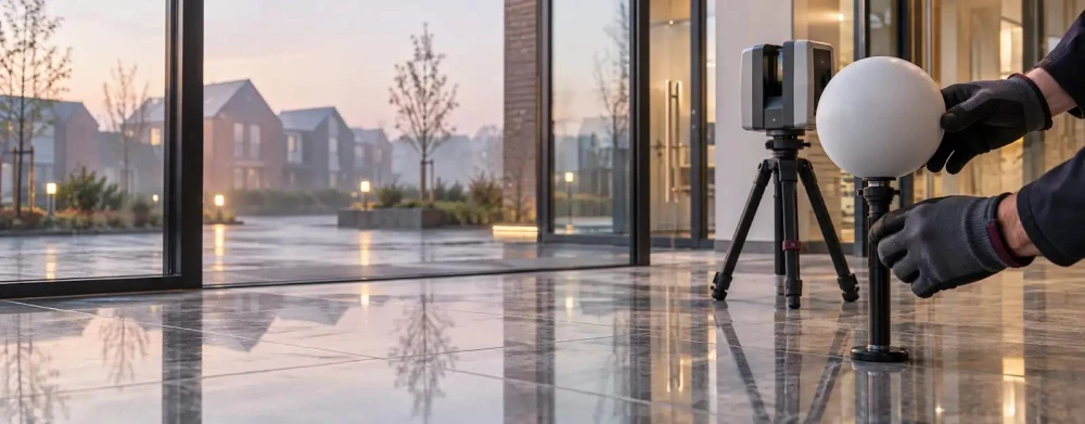
3D Laser Scanning Surveys in Merseyside
Get in TouchAt Survey Hawk, we deliver precise 3D laser scanning surveys in Merseyside, offering accurate site assessments for construction, architecture, and engineering projects. Our technology captures millions of data points, forming detailed 3D models of the surveyed area.
This technique minimizes human error and speeds up project planning by providing comprehensive data of landscapes, buildings, and infrastructure. Covering Merseyside and the surrounding CH62 7 postcode area, we ensure our clients receive the highest level of detail in their survey requirements.
Contact us today to discuss your project's needs.
What Is 3D Laser Scanning Survey?
A 3D laser scanning survey involves using laser technology to capture the shape and dimension of spaces and structures. At Survey Hawk, we use advanced LiDAR (Light Detection and Ranging) and Trimble scanning equipment to produce detailed 3D models of sites in Merseyside, assisting in accurate planning and analysis.
This method captures data points with millimetre precision, providing a rich dataset for various applications. Our method is suitable for varied applications such as topographical mapping, building information modelling (BIM), and heritage preservation.
In addition to traditional construction and civil engineering projects, we support architects and restorers working on heritage sites, where preserving intricate details is paramount. Our surveys help ensure compliance with local planning standards by accurately documenting existing conditions.
The data produced is precise, allowing for virtual walkthroughs and simulations that enhance decision-making processes. We invite you to contact us to discuss how our 3D laser scanning surveys can benefit your next project.
Book 3D Laser Scanning Surveys Today
How Much Does 3D Laser Scanning Survey Cost in Merseyside?
3D laser scanning surveys typically cost between £500 and £1500 per project in Merseyside. The price depends on factors such as the site's size, complexity, and location accessibility.
Smaller, straightforward sites, such as residential properties or small commercial buildings, tend to cost less, around the lower end of the scale. More extensive or intricate projects, such as large industrial complexes or historic sites requiring detailed documentation, require a higher investment.
Our surveys adhere to industry standards like the Leica Geosystems' guidelines to ensure accuracy and reliability. We use Faro or Trimble laser scanning equipment to capture data efficiently, producing precise 3D models.
Projects can usually be completed within a couple of days, though more complex sites may take longer. We can provide a detailed quote based on your project specifications.
Call us to receive a customised estimate tailored to your needs.
Why Choose Survey Hawk for 3D Laser Scanning Surveys in Merseyside?
Survey Hawk offers unparalleled precision in 3D laser scanning surveys in Merseyside. We use advanced laser scanning technology such as the Leica RTC360 and Trimble SX10, which provide high-resolution data with an accuracy of up to 1 millimetre.
This equipment allows us to efficiently capture intricate details of complex structures, even in challenging environments. Our use of point cloud processing techniques enhances data interpretation, enabling detailed analysis and modelling.
We deliver timely results, typically within a matter of days, helping clients reduce lead times for planning and development. Our team meets demanding industry standards like ISO 9001, ensuring quality and consistency in our services.
We are trusted by diverse industries, from construction to heritage sectors, ensuring your project's success. Contact us to see how we can assist with your surveying needs.
What Types of 3D Laser Scanning Surveys Are Available in Merseyside?
We offer multiple 3D laser scanning survey types suited for different project needs:
Topographical Surveys: Detailed mapping of terrain and landscape features, capturing elevations and contours to create accurate 3D models. We use modern Total Station Theodolites and GNSS (Global Navigation Satellite System) equipment to ensure precise data collection, ideal for infrastructure planning and environmental studies.
As-Built Surveys: Precise construction documentation for existing structures, using high-density point cloud data to reflect the current state. This is crucial for retrofitting projects or verifying construction against design specifications, ensuring adherence to RICS (Royal Institution of Chartered Surveyors) standards.
Heritage Surveys: Preservation and restoration data for historic sites, employing techniques like LiDAR (Light Detection and Ranging) to capture fine architectural details with minimal interference. These surveys assist in conservation planning and support compliance with Historic England guidelines.
BIM Surveys: Model creation for building information management, integrating detailed scan data with CAD models. These surveys support facilities management, clash detection, and lifecycle planning, aligning with ISO 19650 standards for BIM implementation.
Each survey type is tailored to specific applications, ensuring the best outcomes for your project. Contact us to discuss your unique requirements.
Speak to a 3D Laser Scanning Surveys Expert
What Are the Benefits of 3D Laser Scanning Surveys in Merseyside?
3D laser scanning surveys offer numerous advantages that make them indispensable for a variety of projects. Using equipment such as LiDAR scanners, these surveys capture data with sub-millimetre precision, ideal for industries like architecture and civil engineering where accuracy is essential.
The technology also supports Building Information Modelling (BIM) processes, ensuring seamless integration with existing project workflows.
Accuracy: Captures comprehensive spatial data accurately, crucial for ensuring structural integrity and compliance with safety standards such as ISO 9001.
Efficiency: Faster data collection reduces survey times and project costs, helping in early-stage design validations and reducing the likelihood of costly reworks.
Safety: Minimises need for dangerous site visits, particularly in hazardous environments like old industrial sites or areas with restricted access.
Versatility: Adapts to various fields, from construction to conservation, aiding projects like heritage preservation where precise documentation is vital.
By choosing Survey Hawk, you gain detailed insights that enhance project planning and execution, whether it's for a new build or a renovation. Request a free consultation to explore the benefits for your project.
Frequently Asked Questions
How is the data from 3D laser scanning surveys used?
The data is used to create precise 3D models for analysis, simulation, and visualisation, aiding accurate planning and development.
How long does a 3D laser scanning survey take in Merseyside?
The survey duration varies, but most projects are completed within a day, with results processed and delivered shortly after.
Is special permission required for 3D laser scanning surveys?
Permissions may be needed for certain sites, especially in protected or sensitive areas. We ensure compliance with all local regulations.
Can 3D laser scanning detect structural issues?
Yes, it uncovers structural deformations and irregularities, enabling preemptive maintenance and repairs.
Is the technology environmentally friendly?
Yes, 3D laser scanning is non-invasive and reduces the need for physical alterations or testing, supporting sustainable practices.
Get a Free Quote for 3D Laser Scanning Surveys in Merseyside
Our team is ready to handle your 3D laser scanning needs. Contact us today and let us provide a detailed overview for your project.
We cover Merseyside