
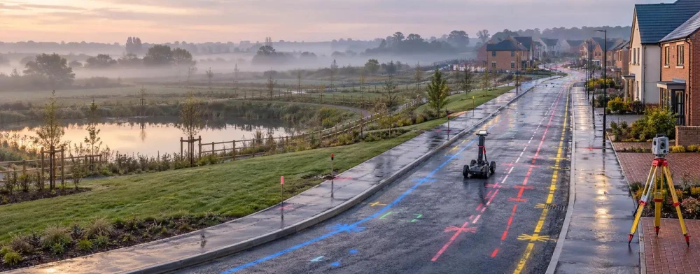
PAS128 Surveys in Dronfield
Get in TouchAt Survey Hawk, we specialise in providing comprehensive PAS128 surveys in Dronfield. These surveys are crucial for accurately mapping underground utilities, ensuring safety and compliance for construction and infrastructure projects.
Our experienced team uses advanced techniques to identify and record the location of utilities, reducing the risk of costly errors during excavation. Covering Dronfield and the surrounding S18 1 postcode area, our service offers precision and reliability.
Contact us today to secure your survey needs and ensure project success.
What Is a PAS128 Survey?
PAS128 surveys are detailed processes we use to map underground utilities with a high level of precision. At Survey Hawk, we perform these surveys in Dronfield to help you identify the presence and location of various utility lines, such as gas, water, electricity, and telecoms.
We employ electromagnetic location (EML) and ground-penetrating radar (GPR) as part of our methodology to detect different materials and depths accurately.
By adhering to the PAS128 standard, we ensure that all findings are reliable and accurate. This involves assessing positional accuracy and quality levels ranging from QL-A to QL-D, where QL-A offers the most accurate positioning, usually verified by actual inspection.
These surveys are invaluable for urban developers, civil engineers, and utility companies, facilitating effective planning for construction and excavation works. They help minimise the risk of damaging underground infrastructure, thereby protecting investments and ensuring site safety.
Contact us today to schedule a survey and avoid unnecessary setbacks.
How Much Does a PAS128 Survey Cost in Dronfield?
A PAS128 survey typically costs between £500 and £1,500 in Dronfield. The exact price depends on factors such as the size of the site, the complexity of the underground network, and the level of detail required.
The survey includes different detection methods like electromagnetic location (EML) and ground-penetrating radar (GPR) to map utilities accurately. Site conditions such as surface materials or local traffic regulations can also influence costs.
Additionally, certain sites may need specific risk assessments or adhere to local council requirements, which we consider when forming our quotes. Surveys on industrial or brownfield sites might necessitate more in-depth investigation, affecting the budget.
At Survey Hawk, we assess each project's unique needs to provide a tailored quote. Call our team today for an accurate estimate based on your specific requirements.
Why Choose Survey Hawk for PAS128 Surveys in Dronfield?
Survey Hawk is the trusted choice for PAS128 surveys in Dronfield because we combine expertise, state-of-the-art technology, and a commitment to precision. Our team is experienced in dealing with complex environments, ensuring that we can meet the specific needs of urban, rural, and industrial sites.
We use both multi-frequency ground-penetrating radar for detailed subsurface imaging and electromagnetic detection to identify utilities like pipes and cables. Our surveys adhere to the PAS128 specification for underground utility detection, classification, and verification, which defines clear standards to achieve detectable results.
Additionally, we employ topographic surveying techniques to provide precise utility mapping and identification, which can be crucial for avoiding costly delays and hazards in construction. Our services can help developers, builders, and planners make informed decisions while ensuring compliance with safety standards.
Contact us today to learn more about how our services can benefit your project.
What Types of PAS128 Surveys Are Available in Dronfield?
In Dronfield, we offer a range of PAS128 survey types to meet various project needs, adhering to the strict standards outlined by PAS128:2014. This ensures consistent quality across all of our surveys.
Desktop Utility Records Search: Collation and analysis of existing utility record plans from diverse sources. This phase enables risk assessment and project planning by identifying potential utility conflicts.
Detection Survey: Using non-intrusive methods such as Ground Penetrating Radar (GPR) and Electro-Magnetic Location (EML) to detect underground utilities. These techniques help avoid unnecessary excavation disruptions.
Verification Survey: Physically identifying utilities through controlled excavation. This involves verification of utility positions and depths, providing greater certainty in high-risk areas.
Location Survey: Accurately mapping the position of utilities with advanced equipment like Electromagnetic Frequency Induction (EFI) locators. This precise mapping is crucial for installations and maintenance.
These types allow us to tailor our services to the specific demands of your project, ensuring the best possible results. Reach out to discuss how our PAS128 surveys can assist your project needs.
How Long Does a PAS128 Survey Take?
Most PAS128 surveys in Dronfield take between one to three days, depending on the size and complexity of the area. A survey of a large industrial site with multiple utilities could take the full three-day period, whereas a smaller residential site might only require a single day.
We use electromagnetic location (EML) and ground-penetrating radar (GPR) to ensure accurate underground utility mapping. These technologies help identify utilities, such as water pipes, gas lines, and telecommunications cables, with precision.
Additional time may be required if on-site verification is needed after initial mapping to confirm the presence or absence of suspected utilities. This verification adheres to the British Standards Institution's PAS128:2014 specification, ensuring our surveys meet industry standards.
Our team at Survey Hawk is committed to providing timely results, allowing your project to proceed with minimal delays.
What Are the Benefits of PAS128 Surveys in Dronfield?
PAS128 surveys provide several benefits in Dronfield for a range of projects, from construction to infrastructure maintenance. These surveys employ ground-penetrating radar (GPR), electromagnetic location and other detection methods to deliver precise data on underground utilities.
Enhanced Safety: Identifies potential hazards like gas lines and electrical cables, thereby reducing the risk of damaging utilities during excavation.
Cost Efficiency: Minimises unexpected project costs caused by unforeseen utility damage, saving both time and materials.
Regulatory Compliance: Ensures adherence to industry standards and legal requirements, such as the Health and Safety at Work Act, thus preventing legal liabilities.
Accurate Planning: Provides reliable data for civil engineers and project managers to avoid delays and disruptions, essential for meeting tight project schedules.
These advantages make PAS128 surveys an essential step in successful project management, offering critical insights into subsurface environments that facilitate informed decision-making. Contact us to schedule your PAS128 survey in Dronfield.
Speak to a PAS128 Surveys Expert
When Is a PAS128 Survey Needed in Dronfield?
A PAS128 survey is required in Dronfield whenever there are plans for excavation, construction, or infrastructure development. These surveys are essential to identify the location of underground utilities accurately, preventing accidental damage.
The survey typically uses methods such as electromagnetic location and ground-penetrating radar to detect pipes, cables, and other underground features. This information helps to ensure precise planning and adherence to project timelines.
They are also crucial for compliance with health and safety regulations, ensuring the safety of workers and the public. In areas with complex utility networks, PAS128 surveys provide insights that can mitigate risks associated with utility strikes and reduce project downtime.
These surveys are often required for commercial sites, residential developments, and public infrastructure projects, where understanding subsurface conditions is critical to maintaining uninterrupted services and avoiding costly repairs.
Frequently Asked Questions
How accurate are PAS128 surveys?
PAS128 surveys in Dronfield provide highly accurate data, typically within 15 to 50 centimetres of the true position of utilities.
Do PAS128 surveys require planning permission?
Planning permission is generally not needed for PAS128 surveys themselves in Dronfield, but it may be required for subsequent excavation work.
How can I book a PAS128 survey?
You can easily book a PAS128 survey through Survey Hawk by contacting our team for a consultation and quote.
What equipment is used in a PAS128 survey?
We use ground-penetrating radar and electromagnetic detection equipment for PAS128 surveys to efficiently locate underground utilities.
Are PAS128 surveys mandatory?
While not always legally required, PAS128 surveys are recommended for construction projects in Dronfield to avoid utility damage and ensure safety compliance.
Get a Free Quote for PAS128 Surveys in Dronfield
Contact Survey Hawk today for a detailed quote tailored to your project's needs.
We cover Dronfield (Derbyshire)