
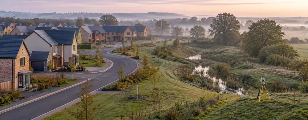
Topographical Surveys in Wood Green
Get in TouchAt Survey Hawk, we offer precise topographical surveys in Wood Green, covering the full N22 6 postcode area. Our surveys generate detailed maps of land and sites, essential for planning, construction, and development projects.
We use advanced equipment to capture every contour and feature, ensuring our clients receive accurate data tailored to their specific needs. Get in touch with us to discuss how we can assist with your project requirements.
What Is a Topographical Survey?
A topographical survey from Survey Hawk is the process of mapping the contours, features, and dimensions of a plot of land in Wood Green. These surveys are crucial for construction and engineering projects, providing detailed diagrams of the land's physical features.
We use sophisticated instruments like electronic distance measurement (EDM) devices, GPS units, and total stations to gather data that highlight the land’s slope, trees, structures, and elevation changes.
In addition to these instruments, we often incorporate aerial drones equipped with LiDAR technology to capture high-resolution images and create highly accurate 3D models of the terrain. This technology is particularly useful in assessing large or inaccessible areas where ground-based methods might be challenging.
Our surveys adhere to rigorous standards such as the British Standard 5964, ensuring the reliability and precision necessary for project planning and development. We cater to a diverse range of clients, from architects and developers to local authorities and environmental consultants, helping them understand the geographical constraints and opportunities of their sites.
Our expertise ensures that every client's specific needs are met, facilitating informed decision-making.
How Much Does a Topographical Survey Cost in Wood Green?
Topographical surveys typically cost from £500 to £1,500 in Wood Green, depending on the survey area size and complexity. The complexity is influenced by various factors such as the terrain type, vegetation cover, and existing infrastructure.
For example, a smaller, straightforward residential plot will cost less, while larger terrains with dense features like wooded or hilly areas may incur a higher cost due to the increased time and equipment necessary for accurate data capture. We use modern equipment like robotic total stations and GNSS receivers to ensure precise measurements and adhere to RICS standards.
These surveys are essential for property developers, architects, and engineers who need accurate site layouts for planning and design purposes. Contact us for an accurate and tailored quotation based on your specific needs and site conditions.
Book Topographical Surveys Today
Why Choose Survey Hawk for Topographical Surveys in Wood Green?
Choosing Survey Hawk for your topographical survey in Wood Green ensures you receive precise, reliable data. Our experienced team is equipped with the latest technology, including GPS-based systems and total stations, which provide high-resolution mapping that is crucial for planning and development.
We adhere to strict industry standards such as the RICS and ISO 9001, ensuring consistent and quality results.
Our surveys serve various sectors, including construction, land development, and environmental management, tackling challenges such as terrain variation and underground utility detection. We also offer digital terrain models (DTM) and contour mapping, essential for architects and engineers who need detailed landscape insights.
Our commitment to customer service and attention to detail makes us a preferred choice. Contact us to see how we can meet your survey needs.
What Are the Benefits of Topographical Surveys in Wood Green?
Topographical surveys offer numerous benefits in Wood Green, making them essential for a variety of construction projects. These surveys provide a detailed and accurate representation of the terrain, crucial for architects and engineers in developing site plans and designs.
They include elevations, positions of existing structures, and natural features, helping to streamline the planning process.
Accurate Planning: With precise data, surveys enable architects and engineers to make informed decisions on building design and layout, reducing errors and costly design alterations.
Risk Mitigation: By identifying potential site issues such as soil instability, flooding zones, and underground utilities, we help prevent delays and construction mishaps.
Cost Efficiency: Early detection of land issues like varying surface levels and drainage problems minimises unforeseen expenses during the construction phase, contributing to overall project savings.
Environmental Protection: Topographical surveys assess environmental impacts, aiding in compliance with environmental regulations and ensuring sustainable development.
These advantages support project timelines and protect investment. Contact us today to take advantage of these benefits.
Speak to a Topographical Surveys Expert
Frequently Asked Questions
How often should I update my topographical survey?
For active construction sites, updating the survey every six months is advisable to reflect any changes accurately.
Are topographical surveys required by law?
While not always legally required, such surveys are often essential for planning permissions and construction projects to comply with regulatory standards.
Can topographical surveys cover large areas?
Yes, our surveys can accommodate large sites, providing mapping over extensive geographic areas.
What information will be shown in my topographical survey?
Your survey will display land contours, features such as trees and buildings, elevation data, and other geographical details pertinent to your site.
How long does it take to complete a topographical survey?
Depending on site size and complexity, a typical survey can take one to three days to complete in Wood Green.
Get a Free Quote for Topographical Surveys in Wood Green
Contact Survey Hawk today to arrange your topographical survey in Wood Green. Our team is ready to provide you with a detailed quote and expert advice tailored to your project.
We cover Wood Green (Greater London)