
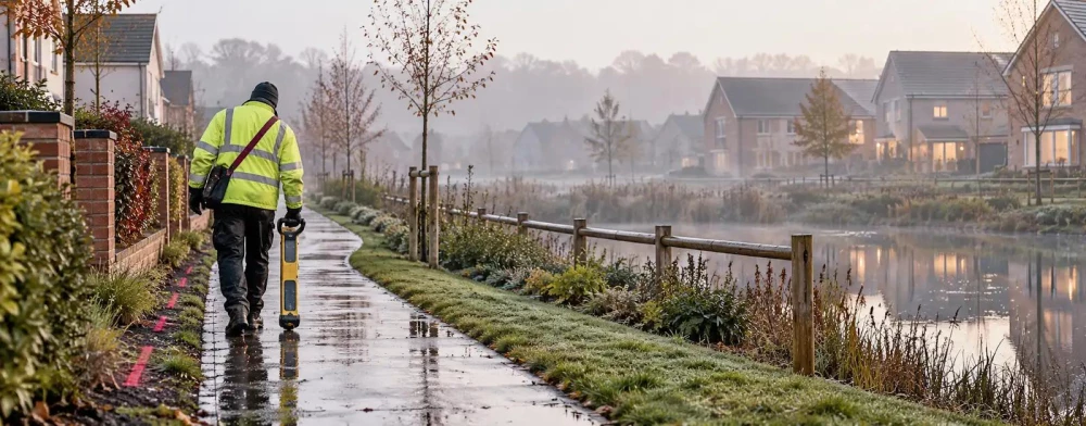
Utility Surveys in Birkenhead
Get in TouchAt Survey Hawk, we specialise in providing comprehensive utility surveys in Birkenhead, offering precise mapping and evaluation of subsurface infrastructure. Our services encompass ground-penetrating radar, electromagnetic detection, and CCTV drainage inspections.
These methods allow us to accurately locate cables, pipes, and other underground utilities, preventing costly disruptions during construction projects. We service various industries, including construction, civil engineering, and urban planning, covering Birkenhead and the surrounding CH41 5 postcode area.
Contact us today to learn how our surveys can benefit your project.
What Is a Utility Survey?
A utility survey is a detailed assessment of underground utilities using specialised techniques aimed at identifying, mapping, and assessing various subsurface services. At Survey Hawk, we use ground-penetrating radar (GPR), electromagnetic detection, and GPS mapping to accurately locate utilities such as water pipes, gas lines, and electrical cables.
GPR helps detect non-metallic pipes, while electromagnetic detection works well for metallic ones. Our GPS mapping provides precise geographic data, essential for integration with geographical information systems (GIS) for ongoing project management.
This information is crucial for construction plans, ensuring safety and compliance with legal requirements, such as PAS 128 standards in utility detection. Our surveys in Birkenhead not only increase the safety of operations but also prevent costly errors by providing a complete overview of subterranean conditions.
We cater to a range of clients, from property developers to municipal authorities, helping them execute their projects with confidence.
How Much Does a Utility Survey Cost in Birkenhead?
Utility surveys typically cost between £300 and £1,500 in Birkenhead, depending on the survey's complexity and site size. The specific needs of a project, such as the requirement for Ground Penetrating Radar (GPR) or Electro-Magnetic Locators (EML), can also impact pricing.
GPR is effective for detecting non-metallic utilities, while EML is useful for identifying metallic services. Factors such as ground conditions, accessibility, and the required level of detail further influence costs.
For instance, a densely populated urban site with numerous obstacles may increase the time and resources needed, leading to higher expenses. For large, complex sites, costs might exceed this range.
At Survey Hawk, we provide clear and competitive pricing, ensuring you receive excellent value for detailed and accurate utility mapping. Contact us to get a tailored quote today.
What Types of Utility Surveys Are Available in Birkenhead?
Several types of utility surveys are available in Birkenhead to suit different project needs, using various technologies and methodologies to ensure precise and comprehensive data collection:
Ground-Penetrating Radar (GPR): Ideal for detecting non-metallic utilities such as fibre optic cables and plastic pipes, and providing accurate depth readings. GPR is effective in diverse soil conditions and is often used in complex urban environments.
Electromagnetic Detection: Commonly used to locate metallic pipes and cables, this method is suitable for identifying electric and telecommunications lines. It provides real-time feedback on the location and depth of metallic utilities, crucial for safe excavation.
CCTV Drain Surveys: Used for inspecting and mapping drainage systems, enabling the identification of blockages, fractures, and root intrusions. CCTV surveys are invaluable in diagnosing drainage issues and planning maintenance schedules.
GPS Mapping: Provides georeferenced data for utility locations, supporting precise documentation and integration into Geographic Information Systems (GIS), beneficial for future planning and compliance with regulatory standards.
Each type offers unique benefits depending on site requirements and project objectives. Our team can guide you on the appropriate type of survey for your needs.
Reach out to us to discuss your project requirements.
Why Choose Survey Hawk for Utility Surveys in Birkenhead?
Choosing Survey Hawk for utility surveys in Birkenhead ensures access to expert knowledge and advanced technology. We use cutting-edge equipment including ground-penetrating radar (GPR) and electromagnetic induction (EMI) detectors.
These technologies allow us to provide precise data on the location and depth of underground utilities, which is crucial for avoiding costly damage. Our experienced team, versed in current PAS 128 standards for utility detection, ensures that each survey is conducted efficiently, reducing disruption and maximising safety.
We work across various sectors including construction, property development, and transport infrastructure, tailoring our surveys to fit the unique demands of each project. Our commitment to detail extends to providing 3D subsurface models and comprehensive utility maps, making the data easily understandable and actionable.
Get in touch with us for reliable and detailed underground mapping.
Speak to a Utility Surveys Expert
Frequently Asked Questions
How Accurate Are Utility Surveys?
Our utility surveys provide precise location data with accuracy typically within 5 to 10 centimetres. Accuracy can vary based on site conditions and survey methods employed.
How Long Does a Utility Survey Take?
Most utility surveys in Birkenhead are completed within a day. However, larger or more complex sites may require two to three days to ensure thorough data collection.
What Information Does a Utility Survey Report Include?
A utility survey report includes detailed maps of underground utilities, depths, and photographic evidence where applicable. These reports help plan safe excavation or construction work.
Who Can Benefit From Utility Surveys?
Construction companies, engineers, architects, and developers benefit from utility surveys by avoiding disruptions and increasing safety during site work.
How Do I Book a Utility Survey with Survey Hawk?
Booking a utility survey with Survey Hawk is straightforward. Simply contact us to discuss your project requirements and receive a tailored quote.
Get a Free Quote for Utility Surveys in Birkenhead
Discover the benefits of utility mapping with Survey Hawk.
We cover Birkenhead (Merseyside)